Recent Project Roundup

We can’t say the extra day we had in February is the sole reason we can share so many great updates with you, but it didn’t hurt. Here’s a little roundup of some of the projects we have been working on or will be soon.

  • The City of Bandon is transitioning to the program we designed specifically for its coastal utility needs. We are excited to see the electric utility team more efficiently handle data collection, visualization, inventory tracking/reporting, and field staking.

  • We kicked off a new project with our friends at the Port of Portland this week. We’ll be providing the Port with an evaluation of the GIS team’s existing suite of applications and technologies. We’ll also assess the alignment of resources to their strategic goals, evaluate strengths and weaknesses, and work with the Port to revise a technical roadmap for their portfolio. Stay tuned for updates!

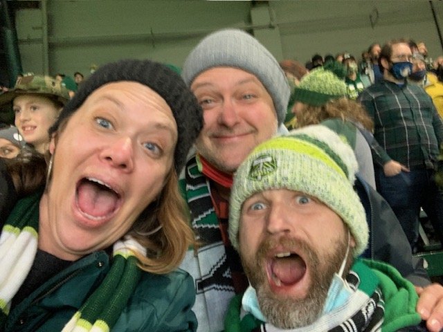
  • We've just put a newly redesigned data replication solution in place for a long-time client, and the improvements are immediately apparent to all involved. Hundreds of folks in their mobile workforce are getting their data reliably, and the back office support team has a suite of resources for system monitoring and alerting. Here’s a behind-the-scenes shot of us working to wrap up the work at a Friday night pizza party.

  • We've finished our work supporting the John Day Basin Partnership on an uplands restoration prioritization project. You can catch the whole scoop on our LinkedIn or Instagram.

  • We have recently completed a GIS Program Maturity Assessment for the City of Forest Grove, Oregon. The 360-degree review of their program enabled our team to present the City with scores across a series of standard metrics used to characterize the maturity of a public sector GIS program. The City is now taking action to improve its program by implementing a set of prioritized recommendations provided with our final report.

  • We’re heading to Palm Springs for the Esri Partner Conference this weekend. Nineteen years into our partnership, there are a lot of familiar faces to catch up with, both on the Esri side and among colleagues who share our enthusiasm for geospatial science.

Did something on this list inspire you? We’d love to help you with your maturity assessment, a migration to the Utility Network, or an update from ArcMap to ArcGIS (security patches end this month!). If you need GIS consulting, a web application for your GIS data, or just want to talk about ideas, please don’t hesitate to contact us. We’re here!

Meet Jenny Axelrod. She does a lot!

Happy 2024, everyone! As our team grows, so does our Team Bio series of blogs. Here to add another story to our collection is our newest full-time employee (who has worked with us for almost a year—but we’ll get to that in a moment). First, let me introduce you to Jenny Axelrod.

Hi Jenny, can you tell us what your job title is?

Senior Geospatial Lead

So, what do you do in this position?

A lot of things... except development. I'm not a developer. I scope and manage projects and contribute to projects as a GIS and Business Analyst. I'm also helping to refine and enhance GIS service delivery, internal processes, and operational procedures.

As I alluded to in the introduction, you are the newest Gartrell Group employee ~ as of January 1st ~ but you’ve been working with us for some time before that, right?

Late in February 2023, I started contracting with Gartrell part-time. I’ve known Bryce and Molly for over a decade since we partnered on a project in Seattle together. I was making a career change and wasn’t sure if I would stay in the GIS realm or pivot to something else. When Bryce and Molly reached out, I figured it was a nice way to give myself time to contemplate, learn more about geospatial development, and make a little money while contributing to their growing business. Fast forward to almost a year later, and we have decided to make it official! My sense of interest and passion for GIS has been reignited, and the fantastic team (also ultra cool, super smart, and quirky-nerdy) is great to work with. I’m back into GIS 100%, and the fact that we are a woman-owned GIS consultancy is a bonus! I’m excited to see where we go in the future.

That’s awesome. I’m glad you decided to stay in GIS. My next question was going to be about your favorite part of the job, but I feel like you kind of answered that with your comment on the ultra-cool, super-smart, and quirky-nerdy team we have.

Yeah. It's a great team, and I appreciate the folks working here.

Where did you grow up?

Minnesota, until I was 20. So also Oregon.

Where in Minnesota? What is childhood in Minnesota like? Is there anything from Minnesota you hold on to (traditions, recipes, ways to be)? Sorry. That’s three questions in one!

I’ll start with where. Cottage Grove. A suburb of St.Paul.

I grew up doing all of the traditional Minnesota things – ice skating and ice fishing on the lakes in the winter, canoeing in the summer, camping in the boundary waters, and going to see ice sculptures at the winter carnival. When I would cross-country ski, I always wanted to go down hills, so I switched to downhill skiing for a little bit. I tried my hand at snowboarding in Minnesota, but it was way too cold, and the snow (ice) was too packed. I picked up snowboarding once I was in Oregon and worked at a Ski Area (Willamette Pass) – the vertical and conditions are WAY better here.

My husband also grew up in the same town (we didn’t start dating until we connected in Oregon as adults), so we have a shared history and “home,” which is nice.

I always have some wild rice in my pantry.

What brought you to Oregon?

I always wanted to live near the ocean and study marine biology when I was little. I also just wanted to move to someplace new, so I moved to Oregon 3 days after I turned 20 with a friend and without a job or place to live waiting for me. It was a great adventure, and a few years later, I ended up studying biology and emphasizing in marine biology at the University of Oregon. GIS came to me later on after I spent five or so years working as a biologist.

Wow. I guess you’re comfortable with traveling!

I’m a big fan of the Mediterranean region and I really want to go sailing in Greece (I’m learning to sail).

I like spending time in a location– 7-9 days in one place or three weeks if you want to hop around to a few locations is perfect. You get into a rhythm of a place and get to know it a bit; I like that. I like to plan some things and leave the in-between times up for whatever comes our way.

My next question was about things you do when not traveling or working. It sounds like sailing is on the list!

Yes. I’m learning to sail. I also like snowboarding, gardening, cooking, playing pinball, doing DIY projects, and playing video games. Oh, and I’m trying my hand at abstract painting.

You mentioned your husband; who else shares your home?
We have an old man dog, Gus, who is very big and is a big baby. And lots of plants.

Well, thanks for taking the time to share, Jenny!

Kubernetes + GIS = Scalable Solutions

Kubernetes is being used for automating deployments, scaling, and managing applications for many industries, but it’s still relatively new to the geospatial community. Our team has begun using this new technology, and we wanted to share what we’ve learned and how it's helping us. We hope to make Kubernetes more approachable and, when possible, lend you our expertise, along with our QA-driven approach to building out a geospatial solution that's right for you.

Not only can we save you time during the deployment of your geospatial infrastructure using Kubernetes, but this technology will also reduce required oversight by automatically scaling and managing your resources.

Our video series, hosted by Jason Berney, is unpacking the basics of the technology and then building on that to explain how it interacts with ArcGIS Enterprise and a variety of cloud providers.

Jason Introduces Kubernetes

Jason Explains Terms and Infrastructure

Jason Explains the Role of a YAML File and Introduces ArcGIS Enterprise

Jason Gives a Big-Picture Approach to ArcGIS Implementation on AWS